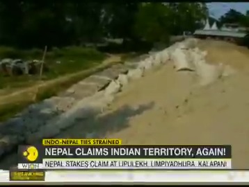
Now, Nepal lays claim over land in Bihar, stops Indians from carrying out embankment work
Barely four days after the Upper House of Nepal’s parliament endorsed a new political map for the country incorporating Indian territories, Nepal has once again contested its international border with India and this time the area of contention happens to be Nepal border with Bihar.
Barely four days after the Upper House of Nepal’s parliament endorsed a new political map for the country incorporating Indian territories, Nepal has once again contested its international border with India and this time the area of contention happens to be Nepal border with Bihar.
In a surprising turn of events, Nepalese authorities stop the officials of Water Resources Department (WRD) of Bihar government from carrying out embankment-related work on the border, claiming the area as part of its territory.
The officials of Bihar government said that they were not allowed by Nepalese authorities from carrying out fortification of an embankment on Lal Bakey River in Bihar’s East Chamaparn district. Bihar government officials said that they were susprised to see the objection of Nepalise authorities as the embankment was constructed over the river many years ago.
According to reports, the WRD authorities tried to sort out the issue at the local level, but the Nepalese failed to listen to their point of view. The Bihar government has now reported the matter to Union Home Ministry, and the Indian Embassy in Nepal.
The new map passed by Nepal’s National Assembly shows Indian territories such as Lipulekh, Kalapani and Limpiyadhura in Uttarakhand as part of Nepalese territory
On June 13, India had reacted strongly after lower house of Nepal Parliament had passed the bill to redraw the political map of the country showing Indian territories as its own. Responding to the development, India had said that “this artificial enlargement of claims is not tenable.”


